In the Wake of Captain James Cook


The scenery is no less dramatic when descending from Gros Morne to Corner Brook. What is special historically is that this area was explored and surveyed extensively in the late 18th century by Captain James Cook.


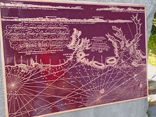
Here is a memorial to Cook with some information and a copy of one of his maps.


Not to mention his statue.


A little more information here.. But if you can manage to see it, Cook's map of Newfoundland (sketch) is placed next to a modern map in colour in the following right hand picture. The accuracy was remarkable.


 |
| Description of the plane table used by Cook for his map-making. |
We then drove down the coastline along the Bay of Islands, named by Cook for obvious reasons as you can see below, as far as Lark Cove, passing Blow-me-down Provincial Park in the process.


What a lovely area and a great place to spend a couple of days. More exploring to come.


Comments
Post a Comment